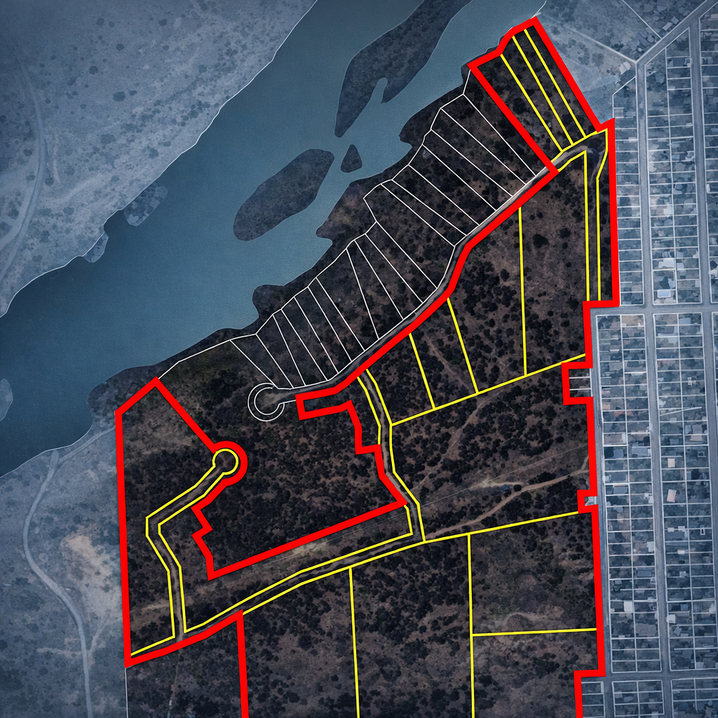
Boundary Verification & Zone Mapping
Establishing a new Tax Increment Financing (TIF) district or a Public Improvement District (PID) requires more than just a general idea of location—it requires survey-grade precision. I specialize in the digital conversion and mathematical verification of legal boundaries to ensure your project stands on solid ground. Beyond the geometry, I can aggregate and analyze appraisal and assessed values for every parcel within the district, providing the critical data needed for financial modeling and statutory compliance.
With a degree in Surveying Engineering and over 25 years of GIS experience, I provide the technical bridge between paper-based legal descriptions and the interactive digital layers required for modern development and municipal compliance.
Metes & Bounds Conversion
The most critical step in district creation is the accurate conversion of "Metes and Bounds" into a GIS environment. I manually process historical deeds and modern plat records using Coordinate Geometry (COGO) to create high-precision digital polygons. This ensures that every bearing and distance is accounted for, providing a reliable foundation for tax assessment and legal exhibits.
Traverse Confirmations
Don't assume a legal description closes perfectly. I perform Traverse Confirmations to identify mathematical errors, gaps, or overlaps before they become legal liabilities.
- Closure Analysis: Calculating the error of closure to verify survey integrity.
- Acreage Audits: Confirming that the physical boundary math matches the claimed legal acreage.
- Discrepancy Resolution: Identifying slivers or voids between adjacent parcels or district boundaries.
"Accuracy in district mapping isn't just about drawing lines; it's about the mathematical certainty that every square foot is correctly accounted for in the statutory record."