Any GIS dataset — public or private — can be transformed into a secure, high-performance interactive map. Whether built on cloud platforms like ArcGIS Online or your own internal infrastructure, your data is displayed in a protected environment to ensure sensitive information stays confidential.
These maps are more than functional tools — they're professional visual solutions. Every dashboard is fully customizable with your branding, colors, and logos to align with your corporate identity. The result is a presentation-ready interface that turns complex spatial data into a clear, compelling story for stakeholders and decision-makers.
Interact with the live examples below. Contact me to discuss a custom solution for your project. More Examples Coming Soon...
Core Variables in Land Comparison
Static spreadsheets only tell half the story. Custom comparable sales maps bring market data to life by visualizing the why behind the price. Recent sales, active listings, and historical trends are aggregated into a single cloud-based interface — letting you compare site characteristics like topography, utility proximity, and zoning side by side.
Undeveloped Land Greater than 5 Acres
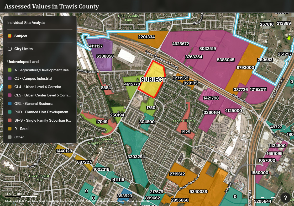
Visualizing undeveloped land parcels (specifically those exceeding 5 acres) is more than a tool; it's a critical instrument for de-risking investment and spatial intelligence. When dealing with significant acreage, physical inspections are often time-consuming and can overlook systemic geographic constraints that an interactive map reveals instantly.
Drivetime & Isochrone Analysis
A drivetime buffer — also known as an isochrone — is a geographic boundary representing the area reachable from a specific point within a set travel time. Unlike a simple radius, it accounts for real-world variables like road networks, speed limits, and traffic patterns, making it a far more accurate tool for trade area analysis and site evaluation.
Territory & Trade Area Mapping
Drive-time isochrones define trade area zones and quantify the demographics within them — enabling precise evaluation of a territory's market potential. Franchisors, retailers, and sales and marketing teams rely on this type of geographic analysis to structure prospecting efforts, optimize campaigns, and assign sales territories with confidence.
Opportunity Zone Mapping
Opportunity Zones are economically distressed communities — designated by states and certified by the U.S. Treasury — where certain investments may qualify for preferential tax treatment. This map helps developers and investors quickly identify which parcels fall within designated zones, supporting due diligence and tax strategy from the earliest stages of site evaluation.