Addressing the Problem with Intelligent Mapping
For many municipalities and organizations, the primary hurdle to progress isn't a lack of vision, but a reliance on legacy mapping infrastructure. Static paper archives, PDFs, and non-attributed CAD drawings are more than just "old", they are a drain on institutional resources. When spatial information remains trapped in these non-intelligent formats, it creates operational bottlenecks that hinder field operations, complicate planning, and slow down decision-making for city councils and developers alike.
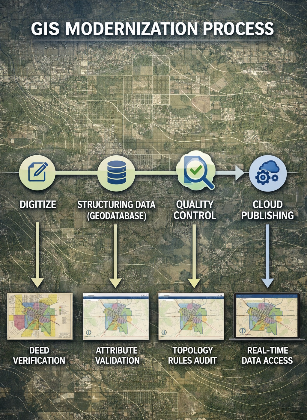
GIS Data Modernization is the process of transforming these visual assets into intelligent, geodatabase-driven systems. By converting legacy data into modern Esri-based environments, your organization can move from reactive map maintenance to proactive spatial analysis. This transition unlocks the power of digital and shareable files, and online mapping - providing real-time access to accurate data across all departments.
Transitioning from Static Files to Intelligent GIS
Many local governments rely on CAD drawings, or other formats, that lack underlying intelligence. My approach focuses on converting this "flat" data into relational features. This allows you to go beyond simple visualization and manage assets. Whether it is municipal boundaries, zoning districts, utility lines, or special districts like TIRZs, MUDs and PIDs, I ensure your legacy data is "cloud-ready."
Data Integrity & Precision Assessments
Modernization isn't just about changing file types, it’s about cleaning up years of accumulated errors. I prioritize audits on every layer during conversion, focusing on data integrity and precision to ensure your digital infrastructure is built on a foundation of absolute accuracy.
- Standardized Digital Exports: Beyond simple file delivery, I provide your data so it's accessible across platforms, whether in the office, an interactive online map, or on mobile devices in the field.
- COGO Traverse Confirmation: I leverage coordinate geometry to verify that digital boundaries match the legal metes and bounds descriptions perfectly.
- Professional Cartographic Presentation: Precision is reinforced through clarity, transforming your data into polished, boardroom-ready visuals that communicate your project’s value.
“Data only becomes powerful when it’s accessible. Modernizing legacy data isn’t about replacing the past - it’s about unlocking the value it was never able to show.”